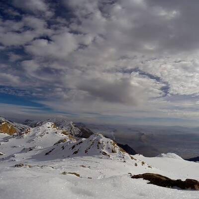
Kermanshah province (Persian: استان کرمانشاه, [Kermānshāh]) is located in a mountainous region and Zagros Mountain range. The climate in the eastern part is temperate and in the western areas is hot and semi-dry, since the land is near the plain of Mesopotamia.
It is a perfect location for nomads as it contains rich grassland and there is plentiful rain and snowfall. From the earliest times, there have been two common lifestyles in the area. The first is migrating nomad life based on husbandry and the second is the country life based on agriculture. Economy in this area is based on three activities: husbandry, agriculture and industry.
Common handicrafts of the province include carpets, rugs, druggets, coarse blankets, etc. People in this province are Kurds, Laks, and Āzarī, they all have their own languages. According to historical evidence and stone inscriptions, especially the famous stone tablet called Ānobānīnī in Sar-e Pol-e Zahāb, civilization in this province dates back to 1600 BC.
Tāgh-e Bostān
The complex of Tāgh-e Bostān is situated in the northeast of Kermānshāh. This is an ancient monument consisting of carved stones and stone tablets dating back to the Sassanid dynasty (224-651). With a view of mountains, springs and flowing water, this place is a perfect resort for visitors. This area used to be a sports park for Sassanid rulers.
Ānāhītā Temple
The remains of Ānāhītā temple are located on the top of a stone hill in Kangāvar town. In Iranian mythology, Ānāhītā was the divinity of waters. The Ānāhītā temple has four sides, each 230 meters in length and in some parts they are 18 meters wide. There are two stairways next to a wall on both sides of the building looking exactly like the stairways of Takht-e Jamshīd (Persepolis). This temple dates back to the time of the Parthian Kingdom (247 BC-224 AD), but most archeological and scientific findings indicate that it is an Achaemenid structure (550-330 BC). On the eastern side, a graveyard belonging to the Parthian era has been found; the deceased are buried in rock graves facing the temple.
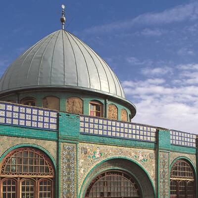
Tekīye Moāven ol-Molk
This place is located in the center of Kermānshāh including three parts, an Abbāsieh, a Hoseīnīeh and a Zeīnabīeh. There are two yards and a building in the middle. The walls are covered by colorful and designed tile-work.
The designs show images of religious and civil figures --mostly from the Qajar era (1789-1925). Some of the designs show religious and historical figures. Solomon (Soleymān Nabī), the Karbala desert, Āshūrā event and the Legend of Rostam and Sohrāb can be named but a few.
Stone Tomb of Sarāb Sahne
Also locally known as Gūr Dakhmeh Shīrīn Va Farhād, the tomb is situated in the north of the town of Sahneh, east of the region of Darband. This tomb is known as the tomb of Keīkāvūs to older local people, as the tomb of Fartāsh to younger people and as the tomb of Farhād and Shīrīn to archeologists. This tomb dates back to the Median era, 550 to 807 B.C.
Bīsotūn Inscriptions
In the heart of Bīstūn Mountains, an inscription has been carved by the order of King Darius of the Achaemenid dynasty (550-330 BC) in three different languages, Old Persian, Elamite and Akkadian. The inscription dates back to 522 BC. The inscription tells the story of two and a half years of Darius' struggles for ascending to throne. The inscription is one of the most valuable historical remains from ancient times.
Ghūrī Ghaleh Cave
Among the oak forests of Orāmānāt and Pāve 90 kilometers away from Kermānshāh City, there is a cave known as Ghūrī Ghaleh which is 3140 meters long. This cave starts from Ghūrī Ghaleh village and continues all the way to Iraq.
There are beautiful halls with golden, dark brown, tan and white walls. There are also curved columns, waterfalls and stalagmites and stalactites as the unique characteristics of this cave.